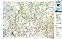
1985 Map of Stillwater
USGS Topo · Published 1991About this map
The St Croix River serves as the central artery for this mid-1980s look at the Minnesota-Wisconsin borderlands, winding through steep-banked valleys between Stillwater and the Twin Cities’ northeastern expansion. The landscape is defined by the heavy presence of glacial lakes, with large clusters around Chisago City and Lindstrom, while massive conservation tracts like the Carlos Avery Wildlife Management Area and the Rice Bed Creek State Wildlife Area preserve the area's wetlands and marshes. Significant riverfront landmarks such as Interstate State Park and William O'Brien State Park mark the transition from the rugged river gorge to the fertile farmland of the Apple River basin. The map reveals the established rail corridors and expanding road networks that connected agricultural hubs like New Richmond and Balsam Lake to the growing urban centers to the west.
Find a feature on this map
204 named features on this map. Tap any name to fly to it.
Don’t see what you’re looking for? This feature index may not catch every label — zoom into the map to look around manually.
Map Details
Editions of this 1985 Stillwater Map
2 editions found
Other maps of this area

1896 · St. Paul
USGS Topo · 1:62,500

1900 · St Croix Dalles
USGS Topo · 1:62,500

1901 · St Croix Dalles
USGS Topo · 1:62,500

1902 · White Bear
USGS Topo · 1:62,500

1940 · Menomonie
USGS Topo · 1:62,500

1942 · Menomonie
USGS Topo · 1:62,500

1946 · Hudson
USGS Topo · 1:62,500

1946 · Knapp
USGS Topo · 1:62,500

1946 · River Falls
USGS Topo · 1:62,500

1948 · New Richmond
USGS Topo · 1:62,500