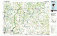
1985 Map of Stillwater
USGS Topo · Published 1985About this map
The Lower St Croix River State Park Riverway anchors this mid-1980s landscape, marking the border between Minnesota and Wisconsin. This map captures the region at a time when the Soo Line and C & NW railroads still defined the logistics of smaller agricultural and timber towns like Deer Park and Arcola. The river corridor, home to Interstate State Park, shows the dramatic geography of Taylors Falls and St Croix Falls, while the surrounding hinterland is dotted with specialized land uses like the Minnesota State Prison and numerous conservation sites, including the Carlos Avery State Wildlife Management Area. Numerous small lake clusters and creek networks such as the Apple River and Sunrise River indicate a landscape dominated by water-level geography, influencing the placement of settlements like Marine on St Croix and the cluster of airports serving the outskirts of the Twin Cities metro area.
Find a feature on this map
292 named features on this map. Tap any name to fly to it.
Don’t see what you’re looking for? This feature index may not catch every label — zoom into the map to look around manually.
Map Details
Editions of this 1985 Stillwater Map
2 editions found
Other maps of this area

1896 · St. Paul
USGS Topo · 1:62,500

1900 · St Croix Dalles
USGS Topo · 1:62,500

1901 · St Croix Dalles
USGS Topo · 1:62,500

1902 · White Bear
USGS Topo · 1:62,500

1940 · Menomonie
USGS Topo · 1:62,500

1942 · Menomonie
USGS Topo · 1:62,500

1946 · Hudson
USGS Topo · 1:62,500

1946 · Knapp
USGS Topo · 1:62,500

1946 · River Falls
USGS Topo · 1:62,500

1948 · New Richmond
USGS Topo · 1:62,500