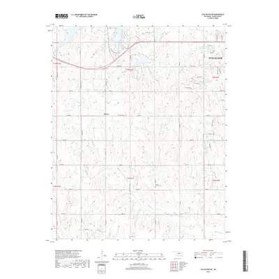
2018 Map of Stillwater SW
USGS Topo · Published 2018About this map
Lake Carl Blackwell and its surrounding creek systems dominate this landscape southwest of the regional hub, where the transitions from rural acreage to residential outskirts are clearly visible. The settlement of Marena serves as a central anchor in a region defined by agricultural sections and local cemeteries, including Marena Cem and Mount Vernon Cem. The hydrology is particularly complex, featuring numerous named drainages like Harrington Cr, Hunt Cr, and Wild Horse Cr that flow through the section-line grid. To the northeast, the growth of Stillwater begins to show in the residential development near W 19th Ave and Greystone St, contrasting with the more isolated southern sections near Paradise Cem. Water management remains a key feature of the terrain, noted by the Stillwater Cr Site 48 Reservoir and the numerically designated 11907 Reservoir.
Find a feature on this map
60 named features on this map. Tap any name to fly to it.
Don’t see what you’re looking for? This feature index may not catch every label — zoom into the map to look around manually.
Map Details
Editions of this 2018 Stillwater SW Map
This is the sole edition of this map. No revisions or reprints were ever made.
Other maps of this area

1892 · Guthrie
USGS Topo · 1:62,500

1893 · Mulhall
USGS Topo · 1:62,500

1893 · Stillwater
USGS Topo · 1:62,500

1909 · Perkins
USGS Topo · 1:62,500

1954 · Oklahoma City
USGS Topo · 1:250,000

1955 · Enid
USGS Topo · 1:250,000

1957 · Oklahoma City
USGS Topo · 1:250,000

1958 · Enid
USGS Topo · 1:250,000

1963 · Oklahoma City
USGS Topo · 1:250,000

1966 · Lake Carl Blackwell
USGS Topo · 1:24,000