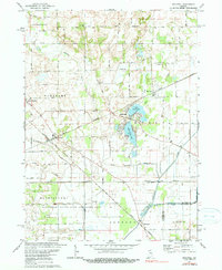
1974 Map of Stillwell
USGS Topo · Published 1990About this map
Stillwell serves as a central rail junction in LaPorte County, where the Grand Trunk Western and Norfolk and Western lines intersect. This 1974 survey captures the landscape during a period of transition, preserving the alignment of historical routes like Treaty Boundary Road and the established rural community of Salem Heights. To the north, Oak Grove Ch stands as a local landmark near the Cranberry Bog, illustrating the original wetland character of the region before extensive drainage.
Find a feature on this map
45 named features on this map. Tap any name to fly to it.
Don’t see what you’re looking for? This feature index may not catch every label — zoom into the map to look around manually.
Map Details
Editions of this 1974 Stillwell Map
2 editions found
Other maps of this area

1953 · Chicago
USGS Topo · 1:250,000

1957 · Chicago
USGS Topo · 1:250,000

1958 · Lydick
USGS Topo · 1:24,000

1958 · Kingsford Heights
USGS Topo · 1:24,000

1958 · Hamlet
USGS Topo · 1:24,000

1958 · Walkerton
USGS Topo · 1:24,000

1958 · Stillwell
USGS Topo · 1:24,000

1958 · North Liberty
USGS Topo · 1:24,000

1958 · La Porte East
USGS Topo · 1:24,000

1958 · Springville
USGS Topo · 1:24,000