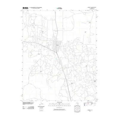
2010 Map of Stinnett
USGS Topo · Published 2010About this map
Stinnett serves as the central hub of this Hutchinson County landscape, surrounded by the clear imprints of the Texas Panhandle's energy industry. The presence of the Stinnett Oil Field and the Canadian Gasoline Plant highlights the region's reliance on petroleum and natural gas resources during this early 21st-century period. Industrial and residential clusters, often identified as camps, are scattered throughout the territory, including Supreme Camp, Creslenn Camp, and Stekoll Camp, indicating localized workforce settlements tied to specific operations.
Find a feature on this map
27 named features on this map. Tap any name to fly to it.
Don’t see what you’re looking for? This feature index may not catch every label — zoom into the map to look around manually.
Map Details
Editions of this 2010 Stinnett Map
This is the sole edition of this map. No revisions or reprints were ever made.
Other maps of this area

1939 · Sanford
USGS Topo · 1:62,500

1953 · Sanford
USGS Topo · 1:24,000

1953 · Plemons
USGS Topo · 1:24,000

1953 · Stinnett
USGS Topo · 1:24,000

1953 · Stinnett Station
USGS Topo · 1:24,000

1953 · Pringle
USGS Topo · 1:24,000

1953 · Phillips
USGS Topo · 1:24,000

1953 · Borger
USGS Topo · 1:24,000

1954 · Amarillo
USGS Topo · 1:250,000

1958 · Amarillo
USGS Topo · 1:250,000