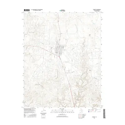
2016 Map of Stinnett
USGS Topo · Published 2016About this map
Stinnett serves as the central hub of this High Plains landscape, situated at the junction of several critical regional corridors. The town's grid is detailed with residential streets like S Elm Ave and N Main St, while the Stinnett Cem marks the western edge of the developed area. The topography is defined by the sharp incisions of Cottonwood Creek and Smokeyhouse Cr, which carve through the plateau toward the northeast. This 2016 survey captures a rural Texas economy anchored by cattle ranching and localized water features like Britain Lake. To the east, the small settlement of Dial is located near a network of ranch roads, including Herring Ranch Rd, illustrating the persistence of dispersed rural communities in Hutchinson County. Prominent local landmarks such as Signal Hill provide navigational points above the creek drainage systems.
Find a feature on this map
58 named features on this map. Tap any name to fly to it.
Don’t see what you’re looking for? This feature index may not catch every label — zoom into the map to look around manually.
Map Details
Editions of this 2016 Stinnett Map
This is the sole edition of this map. No revisions or reprints were ever made.
Other maps of this area

1939 · Sanford
USGS Topo · 1:62,500

1953 · Sanford
USGS Topo · 1:24,000

1953 · Plemons
USGS Topo · 1:24,000

1953 · Stinnett
USGS Topo · 1:24,000

1953 · Stinnett Station
USGS Topo · 1:24,000

1953 · Pringle
USGS Topo · 1:24,000

1953 · Phillips
USGS Topo · 1:24,000

1953 · Borger
USGS Topo · 1:24,000

1954 · Amarillo
USGS Topo · 1:250,000

1958 · Amarillo
USGS Topo · 1:250,000