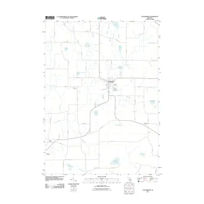
2011 Map of Stockbridge
USGS Topo · Published 2011About this map
Stockbridge serves as the central hub of this South Michigan landscape, where the confluence of Portage Creek and Nichols Lake anchors the local geography. The area is defined by a dense network of glacial lakes and wetlands, including Lowe Lake, Whitehead Lake, and Bartig Lake, connected by drainage systems like Lowe Drain and Orchard Creek. This hydrology shaped the local settlement patterns, with roads like Territorial Rd and Dexter Trl navigating around the water bodies.
Find a feature on this map
61 named features on this map. Tap any name to fly to it.
Don’t see what you’re looking for? This feature index may not catch every label — zoom into the map to look around manually.
Map Details
Editions of this 2011 Stockbridge Map
This is the sole edition of this map. No revisions or reprints were ever made.
Other maps of this area

1908 · Fowlerville
USGS Topo · 1:62,500

1909 · Mason
USGS Topo · 1:62,500

1910 · Fowlerville
USGS Topo · 1:62,500

1911 · Mason
USGS Topo · 1:62,500

1919 · Stockbridge
USGS Topo · 1:62,500

1919 · Rives Junction
USGS Topo · 1:62,500

1921 · Rives Junction
USGS Topo · 1:62,500

1922 · Stockbridge
USGS Topo · 1:62,500

1942 · Stockbridge
USGS Topo · 1:62,500

1958 · Grand Rapids
USGS Topo · 1:250,000
Featured Places
- Unadilla Township, MI
- Lyndon Township, MI
- Stockbridge, MI
- Waterloo Township, MI
- Stockbridge Township, MI