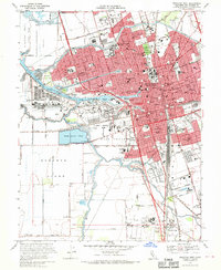
1968 Map of Stockton West
USGS Topo · Published 1970About this map
The San Joaquin River and its intricate network of sloughs and canals anchor this 1968 study of Central Valley infrastructure and urban expansion. Industrial and maritime activity is concentrated at the Port of Stockton and the Stockton Deep Water Channel, while the surrounding landscape reveals the transitioning character of tracts like Sargent-Barnhart Tract and Roberts Island. The map records a dense concentration of civic and social institutions, from the University of the Pacific and the State Hospital to numerous parochial schools such as St Marys Assumption Sch. Transportation history is well-preserved here, showing the convergence of the Southern Pacific, Western Pacific, and the Stockton Terminal and Eastern railroads. To the south, the Sharpe Army Depot (Field Annex) and Stockton Metropolitan Airport mark the city's mid-century military and logistical footprint.
Find a feature on this map
112 named features on this map. Tap any name to fly to it.
Don’t see what you’re looking for? This feature index may not catch every label — zoom into the map to look around manually.
Map Details
Editions of this 1968 Stockton West Map
3 editions found
Other maps of this area

1894 · Lodi
USGS Topo · 1:125,000

1908 · Waterloo
USGS Topo · 1:31,680

1910 · Castle
USGS Topo · 1:31,680

1910 · Headreach
USGS Topo · 1:31,680

1913 · Stockton
USGS Topo · 1:31,680

1913 · Holt
USGS Topo · 1:31,680

1914 · Burnham
USGS Topo · 1:31,680

1914 · Manteca
USGS Topo · 1:31,680

1914 · Union Island
USGS Topo · 1:31,680

1915 · Lathrop
USGS Topo · 1:31,680