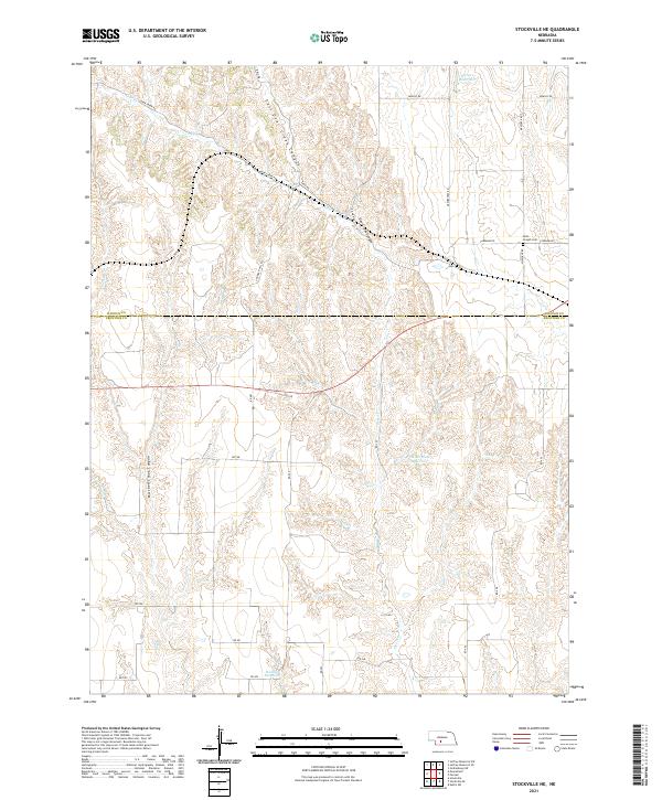
2021 Map of Stockville NE
USGS Topo · Published 2021About this map
Deep drainage networks including East Deer Creek Canyon and Mitchell Creek Canyon carve through this high plains landscape along the border of Lincoln and Frontier counties. The terrain is defined by these steep draws that feed toward Deer Cr, a tributary system managed by scattered upland impoundments such as Harper Reservoir, Wintermute Reservoir, and Walther Reservoir. These water features highlight the importance of moisture management in this agricultural region.
Find a feature on this map
30 named features on this map. Tap any name to fly to it.
Don’t see what you’re looking for? This feature index may not catch every label — zoom into the map to look around manually.
Map Details
Editions of this 2021 Stockville NE Map
This is the sole edition of this map. No revisions or reprints were ever made.
Other maps of this area

1902 · Gothenburg
USGS Topo · 1:125,000

1954 · McCook
USGS Topo · 1:250,000

1956 · Jeffrey Reservoir SW
USGS Topo · 1:24,000

1956 · Stockville NE
USGS Topo · 1:24,000

1956 · Moorefield
USGS Topo · 1:24,000

1956 · Stockville
USGS Topo · 1:24,000

1956 · Stockville SE
USGS Topo · 1:24,000

1957 · McCook
USGS Topo · 1:250,000

1958 · McCook
USGS Topo · 1:250,000
1970 · Eustis SW
USGS Topo · 1:24,000