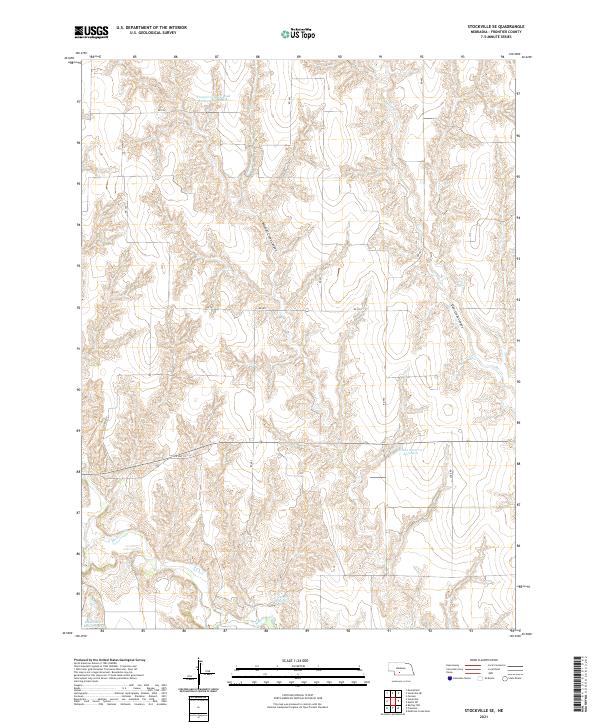
2021 Map of Stockville SE
USGS Topo · Published 2021About this map
Mitchell Creek Canyon and Deer Creek Canyon dominate the topography of this Frontier County landscape, where the high plains of Nebraska are deeply carved by erosion. The area is characterized by an extensive system of water management features, including Frontier County Road Reservoir Number 1, Hinton Reservoir Number 1, and Davis Reservoir, which serve the local agricultural needs. A network of rural roads like RD 744 and RD 403 provides the primary infrastructure connecting the high ground to the drainage basins of Medicine Cr and Cedar Cr. This survey illustrates a modern rural landscape where the natural hydrology of the plains has been systematically modified for storage and control, reflecting the ongoing intersection of land use and water conservation in this part of the state.
Find a feature on this map
24 named features on this map. Tap any name to fly to it.
Don’t see what you’re looking for? This feature index may not catch every label — zoom into the map to look around manually.
Map Details
Editions of this 2021 Stockville SE Map
This is the sole edition of this map. No revisions or reprints were ever made.
Other maps of this area

1902 · Gothenburg
USGS Topo · 1:125,000

1954 · McCook
USGS Topo · 1:250,000

1956 · Freedom
USGS Topo · 1:24,000

1956 · Stockville NE
USGS Topo · 1:24,000

1956 · Moorefield
USGS Topo · 1:24,000

1956 · Medicine Creek Dam
USGS Topo · 1:24,000

1956 · Stockville
USGS Topo · 1:24,000

1956 · Bartley NW
USGS Topo · 1:24,000

1956 · Stockville SE
USGS Topo · 1:24,000

1957 · McCook
USGS Topo · 1:250,000