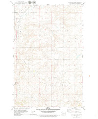
1979 Map of Stockyard Creek
USGS Topo · Published 1979About this map
The high plains of Williams County are defined here by the sharp coulees and drainage systems of Stockyard Creek and Long Creek. During the late 1970s, this rural landscape was marked by the presence of a local Townhall and several Radio Towers, indicating a decentralized community infrastructure typical of western North Dakota. The Burlington Northern railroad cuts through the northwestern corner, a vital artery for the region's agricultural and industrial transport. Territorial divisions like Spring Brook and Twelve Mile partition the land, which is also shaped by extractive activity at various Gravel Pits. The map illustrates the contrast between the vast, open sections of rangeland and the intricate, branching waterways that carve through the prairie terrain.
Find a feature on this map
11 named features on this map. Tap any name to fly to it.
Don’t see what you’re looking for? This feature index may not catch every label — zoom into the map to look around manually.
Map Details
Editions of this 1979 Stockyard Creek Map
This is the sole edition of this map. No revisions or reprints were ever made.
Other maps of this area

1911 · Ray
USGS Topo · 1:125,000

1953 · Williston
USGS Topo · 1:250,000

1957 · Williston
USGS Topo · 1:250,000

1959 · Marmon SE
USGS Topo · 1:24,000

1959 · Williston East
USGS Topo · 1:24,000

1978 · Lake Jessie
USGS Topo · 1:24,000

1978 · Epping
USGS Topo · 1:24,000

1978 · Spring Brook
USGS Topo · 1:24,000
1978 · Gamache Creek
USGS Topo · 1:24,000
1979 · Chris Creek
USGS Topo · 1:24,000