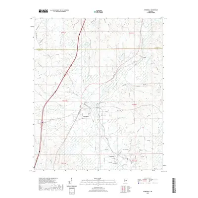
2020 Map of Stonewall
USGS Topo · Published 2020About this map
The confluence of the Chunky River and Okatibbee Creek forms the Chickasawhay River north of Enterprise, marking a significant hydrologic junction in Clarke County. This 2020 record illustrates the enduring footprints of industrial and river-based settlements, from the namesake town of Stonewall to the small community of Basic further north. The landscape is defined by its watercourses, including Dunns Falls and numerous family-named branches like Kidd Br and Allen Br. Genealogists will find a wealth of localized data through many burial sites, such as the Enterprise Cem, Stonewall Cem, and the more remote Zion Chapel Cem. The transition from rural roads like Stucky Bridge Rd to the established grids of Enterprise and Stonewall highlights the historical development patterns along the river valley.
Find a feature on this map
102 named features on this map. Tap any name to fly to it.
Don’t see what you’re looking for? This feature index may not catch every label — zoom into the map to look around manually.
Map Details
Editions of this 2020 Stonewall Map
This is the sole edition of this map. No revisions or reprints were ever made.
Other maps of this area

1921 · Meridian
USGS Topo · 1:48,000

1923 · Meridian
USGS Topo · 1:62,500

1953 · Meridian
USGS Topo · 1:250,000

1957 · Meridian
USGS Topo · 1:250,000

1957 · Chunky
USGS Topo · 1:62,500

1957 · Quitman
USGS Topo · 1:62,500

1957 · Enterprise
USGS Topo · 1:62,500

1965 · Meridian
USGS Topo · 1:250,000

1971 · Meridian South
USGS Topo · 1:24,000

1982 · Meehan
USGS Topo · 1:24,000