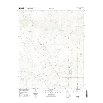
2016 Map of Stonewall
USGS Topo · Published 2016About this map
Stonewall serves as the primary hub in this eastern section of Pontotoc County, where the street grid of the town site meets the winding course of Buck Cr. The landscape is defined by an extensive water management system featuring numerous reservoirs, including Upper Clear Boggy Cr Site 45 Reservoir and Upper Clear Boggy Cr Site 48 Reservoir, which dot the drainage basins of Clear Boggy Cr and its tributaries. For those researching local history, the map provides precise locations for several burial grounds, such as Malville Cem, Cockran Cem, and Frisco Cem, located near the small community of Frisco. The transition between the rural uplands and the river bottoms is marked by a network of section-line roads and specialized landing strips like Thomas Ranch Airport and Valley Airport, reflecting the region's agricultural and ranching character.
Find a feature on this map
97 named features on this map. Tap any name to fly to it.
Don’t see what you’re looking for? This feature index may not catch every label — zoom into the map to look around manually.
Map Details
Editions of this 2016 Stonewall Map
This is the sole edition of this map. No revisions or reprints were ever made.
Other maps of this area

1896 · Coalgate
USGS Topo · 1:125,000

1899 · Coalgate
USGS Topo · 1:125,000

1900 · Coalgate
USGS Topo · 1:125,000

1901 · Stonewall
USGS Topo · 1:125,000

1957 · Stonewall
USGS Topo · 1:24,000

1957 · Ardmore
USGS Topo · 1:250,000

1958 · Lula
USGS Topo · 1:24,000

1958 · Francis
USGS Topo · 1:24,000

1958 · Steedman
USGS Topo · 1:24,000

1958 · Ada
USGS Topo · 1:24,000