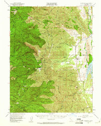
1951 Map of Stonyford
USGS Topo · Published 1961About this map
Stonyford serves as a vital mountain gateway on this mid-century survey, situated where the high ridges of the Mendocino National Forest meet the irrigation infrastructure of the East Park Reservoir. The map reveals a landscape defined by ranching and resource management, featuring the Stonyford Rancheria (Site) and scattered homesteads like Brittan Ranch and Meyers Cabin. The region's thermal geology is evident through several named mineral springs, including Pouts Springs, Champagne Spr, and Cooks Springs. Higher elevations are punctuated by fire lookouts at Sheetiron Mtn Lookout and Goat Mtn Lookout, overlooking the Snow Mountain State Game Refuge. Mining history is represented by the Ruby King Mine, while the valley floor shows the complex water management system of the Diversion and Canal along Stony Creek.
Find a feature on this map
87 named features on this map. Tap any name to fly to it.
Don’t see what you’re looking for? This feature index may not catch every label — zoom into the map to look around manually.
Map Details
Editions of this 1951 Stonyford Map
3 editions found

Other maps of this area

1919 · Fruto
USGS Topo · 1:62,500

1919 · Elk Creek
USGS Topo · 1:62,500

1920 · Venado
USGS Topo · 1:62,500

1922 · Hullville
USGS Topo · 1:62,500

1924 · Bartlett Springs
USGS Topo · 1:62,500

1938 · Lakeport
USGS Topo · 1:62,500

1942 · Bartlett Springs
USGS Topo · 1:62,500

1943 · Lodoga
USGS Topo · 1:62,500

1944 · Bartlett Springs
USGS Topo · 1:62,500

1944 · Fruto
USGS Topo · 1:62,500