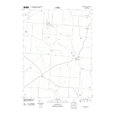
2010 Map of Stoutsville
USGS Topo · Published 2010About this map
Tarlton Cross Mound anchors the eastern side of this Fairfield and Pickaway County landscape, marking a significant cultural site near the village of Tarlton. This area is characterized by a high density of family and denominational burial grounds, such as the Stoutsville Reform Cemetery, Rice and Black Cemetery, and Saint Pauls Evangelical Cemetery, providing a detailed record for genealogical research. The settlement pattern follows the drainage of Scippo Creek and Salt Creek, where small rural hubs like Stoutsville and Leistville grew at key road intersections. The topography rises toward Chestnut Ridge and Pumpkin Ridge in the east, while the west remains dominated by the agricultural drainages of Kinnikinnick Creek and Plum Run. These waterways and the network of local roads, such as Stoutsville Pike and Zane Trail Rd, illustrate the long-standing transport routes connecting these central Ohio farming communities.
Find a feature on this map
73 named features on this map. Tap any name to fly to it.
Don’t see what you’re looking for? This feature index may not catch every label — zoom into the map to look around manually.
Map Details
Editions of this 2010 Stoutsville Map
This is the sole edition of this map. No revisions or reprints were ever made.
Other maps of this area

1906 · Chillicothe
USGS Topo · 1:62,500

1907 · Lancaster
USGS Topo · 1:62,500

1908 · Chillicothe
USGS Topo · 1:62,500

1909 · Lancaster
USGS Topo · 1:62,500

1910 · Laurelville
USGS Topo · 1:62,500

1912 · Laurelville
USGS Topo · 1:62,500

1914 · Circleville
USGS Topo · 1:62,500

1943 · Circleville
USGS Topo · 1:62,500

1944 · Laurelville
USGS Topo · 1:62,500

1947 · Columbus
USGS Topo · 1:250,000