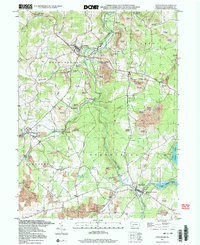
1994 Map of Stoystown
USGS Topo · Published 2000About this map
The Stonycreek River winds through this section of Somerset County, where the landscape reveals a complex history of resource extraction and rural settlement. Large tracts of Reclaimed Strip Mines dominate the high ground east of Stoystown and Kantner, illustrating the extensive mid-century coal operations that reshaped the terrain. In the valleys, older community structures persist, from the Covered Bridge on the river to the Stone Bridge in the north.
Find a feature on this map
40 named features on this map. Tap any name to fly to it.
Don’t see what you’re looking for? This feature index may not catch every label — zoom into the map to look around manually.
Map Details
Editions of this 1994 Stoystown Map
2 editions found
Other maps of this area

1913 · Somerset
USGS Topo · 1:62,500

1914 · Windber
USGS Topo · 1:62,500

1915 · Somerset
USGS Topo · 1:62,500

1916 · Windber
USGS Topo · 1:62,500

1921 · Meyersdale
USGS Topo · 1:62,500

1923 · Berlin
USGS Topo · 1:48,000

1929 · Berlin
USGS Topo · 1:62,500

1939 · Meyersdale
USGS Topo · 1:62,500

1944 · Somerset
USGS Topo · 1:62,500

1944 · Windber
USGS Topo · 1:62,500