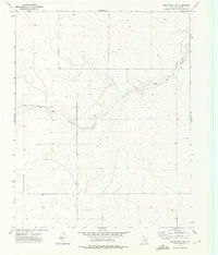
1973 Map of Stratford 2 SW
USGS Topo · Published 1976About this map
Red Cow Draw winds across this section of the Texas Panhandle, defining the drainage patterns of the high plains in Dallam County. Surveyed in the early 1970s, the landscape is primarily characterized by its vast open terrain and agricultural infrastructure. Human imprint is visible through scattered ranching or resource extraction points, including a Drill Hole and several instances of a Well located throughout the survey area. These features suggest the vital importance of water and subsurface management in this semi-arid region during the post-war era. The map serves as a precise record of the topography and land use before subsequent decades of modern development, focusing on the essential relationship between the seasonal watercourse of the draw and the surrounding prairie.
Find a feature on this map
3 named features on this map. Tap any name to fly to it.
Don’t see what you’re looking for? This feature index may not catch every label — zoom into the map to look around manually.
Map Details
Editions of this 1973 Stratford 2 SW Map
2 editions found
Other maps of this area

1954 · Dalhart
USGS Topo · 1:250,000

1958 · Dalhart
USGS Topo · 1:250,000

1962 · Dalhart
USGS Topo · 1:250,000

1964 · Stratford 2 SE
USGS Topo · 1:24,000

1964 · Stratford 2 NE
USGS Topo · 1:24,000

1965 · Wilco NE
USGS Topo · 1:24,000

1973 · Stratford 2 NW
USGS Topo · 1:24,000

1973 · Bolin NE
USGS Topo · 1:24,000

1973 · Coldwater East
USGS Topo · 1:24,000
1973 · Pritchard Ranch
USGS Topo · 1:24,000