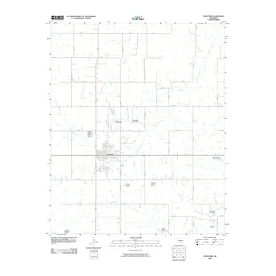
2009 Map of Stratford
USGS Topo · Published 2009About this map
The town of Stratford serves as the central hub of this Garvin County landscape, where a grid of rural roads like Golden Ave and Chism Ave connects agricultural land with local industry. To the south, the Southeast Stratford Oil Field indicates the importance of petroleum extraction to the local economy, while the Diamond C Ranch Airport sits nestled among the fields to the east. The terrain is defined by a series of water management projects, including numerous flood control structures such as Sandy Creek Site 19 Dam and Cherokee Sandy Site 8a Dam. These features, alongside the meandering paths of Spring Brook Creek and Burris Creek, show a region carefully engineered to balance ranching and resource production. For genealogists, the Midland Cemetery in the southeast corner provides a primary point of historical interest.
Find a feature on this map
31 named features on this map. Tap any name to fly to it.
Don’t see what you’re looking for? This feature index may not catch every label — zoom into the map to look around manually.
Map Details
Editions of this 2009 Stratford Map
This is the sole edition of this map. No revisions or reprints were ever made.
Other maps of this area

1898 · Pauls Valley
USGS Topo · 1:125,000

1901 · Stonewall
USGS Topo · 1:125,000

1902 · Pauls Valley
USGS Topo · 1:125,000

1957 · Ardmore
USGS Topo · 1:250,000

1958 · Konawa
USGS Topo · 1:24,000

1963 · Ardmore
USGS Topo · 1:250,000

1964 · Byars
USGS Topo · 1:24,000

1965 · Pauls Valley NE
USGS Topo · 1:24,000
1965 · Wanette
USGS Topo · 1:24,000

1966 · Asher
USGS Topo · 1:24,000