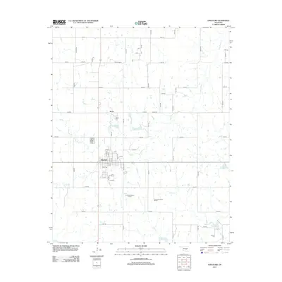
2012 Map of Stratford
USGS Topo · Published 2012About this map
Stratford serves as the primary hub of this landscape, exhibiting a structured grid of residential streets including Drake St and Patterson, which define the local community's footprint south of Big Cr. The area’s economic and historical legacy is evident in the transition from agricultural lands to industrial utility, highlighted by the Southeast Stratford Oil Field and the Diamond C Ranch Airport.
Find a feature on this map
69 named features on this map. Tap any name to fly to it.
Don’t see what you’re looking for? This feature index may not catch every label — zoom into the map to look around manually.
Map Details
Editions of this 2012 Stratford Map
This is the sole edition of this map. No revisions or reprints were ever made.
Other maps of this area

1898 · Pauls Valley
USGS Topo · 1:125,000

1901 · Stonewall
USGS Topo · 1:125,000

1902 · Pauls Valley
USGS Topo · 1:125,000

1957 · Ardmore
USGS Topo · 1:250,000

1958 · Konawa
USGS Topo · 1:24,000

1963 · Ardmore
USGS Topo · 1:250,000

1964 · Byars
USGS Topo · 1:24,000

1965 · Pauls Valley NE
USGS Topo · 1:24,000
1965 · Wanette
USGS Topo · 1:24,000

1966 · Asher
USGS Topo · 1:24,000