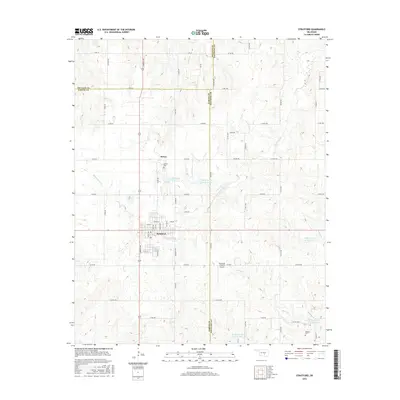
2016 Map of Stratford
USGS Topo · Published 2016About this map
Stratford serves as the primary hub in this central Oklahoma landscape, situated at the crossroads where State Highway 19 meets several county arteries. The area's agricultural and rural character is defined by a dense network of sectional roads and various water management projects, including a series of reservoirs like Sandy Cr Site 27 Reservoir and Sandy Cr Site 19 Reservoir. These landmarks reflect the managed hydrology of the Spring Brook Cr and Burris Cr drainages.
Find a feature on this map
65 named features on this map. Tap any name to fly to it.
Don’t see what you’re looking for? This feature index may not catch every label — zoom into the map to look around manually.
Map Details
Editions of this 2016 Stratford Map
This is the sole edition of this map. No revisions or reprints were ever made.
Other maps of this area

1898 · Pauls Valley
USGS Topo · 1:125,000

1901 · Stonewall
USGS Topo · 1:125,000

1902 · Pauls Valley
USGS Topo · 1:125,000

1957 · Ardmore
USGS Topo · 1:250,000

1958 · Konawa
USGS Topo · 1:24,000

1963 · Ardmore
USGS Topo · 1:250,000

1964 · Byars
USGS Topo · 1:24,000

1965 · Pauls Valley NE
USGS Topo · 1:24,000
1965 · Wanette
USGS Topo · 1:24,000

1966 · Asher
USGS Topo · 1:24,000