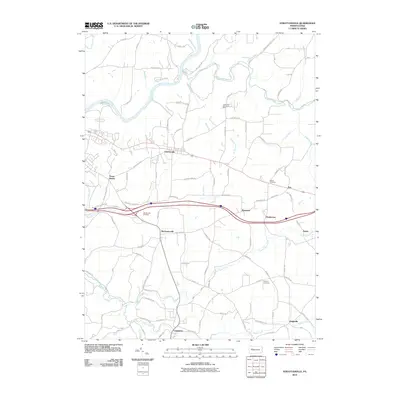
2010 Map of Strattanville
USGS Topo · Published 2010About this map
The Clarion River winds through the northern reaches of this Clarion County landscape, carved by numerous tributaries such as Mill Creek and Reed Run. The borough of Strattanville serves as a central hub, situated along a primary east-west corridor that connects smaller communities including Waterson, Henderson, and Day. To the south, the settlement of Limestone anchors a region defined by the valley of Little Piney Creek.
Find a feature on this map
100 named features on this map. Tap any name to fly to it.
Don’t see what you’re looking for? This feature index may not catch every label — zoom into the map to look around manually.
Map Details
Editions of this 2010 Strattanville Map
This is the sole edition of this map. No revisions or reprints were ever made.
Other maps of this area

1906 · Clarion
USGS Topo · 1:62,500

1907 · Clarion
USGS Topo · 1:62,500

1918 · Loleta
USGS Topo · 1:62,500

1922 · Tionesta
USGS Topo · 1:62,500

1924 · Tionesta
USGS Topo · 1:62,500

1924 · Brookville
USGS Topo · 1:62,500

1926 · Brookville
USGS Topo · 1:62,500

1936 · Marienville
USGS Topo · 1:48,000

1941 · Marienville
USGS Topo · 1:62,500

1944 · Brookville
USGS Topo · 1:62,500