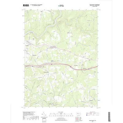
2019 Map of Strattanville
USGS Topo · Published 2019About this map
The Clarion River carves a deep valley through the northern half of this landscape, flanked by the residential blocks of eastern Clarion and the village of Strattanville. This 2019 survey documents a region defined by its traditional small-town centers and numerous ancestral resting places, including the Old Seceder Cem and the New Rehoboth-Greenville Presbyterian Church Cem. The road network connects older settlements like Mechanicsville and Limestone via Rte 66, while Interstate 80 creates a modern east-west corridor through the center of the quadrangle.
Find a feature on this map
103 named features on this map. Tap any name to fly to it.
Don’t see what you’re looking for? This feature index may not catch every label — zoom into the map to look around manually.
Map Details
Editions of this 2019 Strattanville Map
This is the sole edition of this map. No revisions or reprints were ever made.
Other maps of this area

1906 · Clarion
USGS Topo · 1:62,500

1907 · Clarion
USGS Topo · 1:62,500

1918 · Loleta
USGS Topo · 1:62,500

1922 · Tionesta
USGS Topo · 1:62,500

1924 · Tionesta
USGS Topo · 1:62,500

1924 · Brookville
USGS Topo · 1:62,500

1926 · Brookville
USGS Topo · 1:62,500

1936 · Marienville
USGS Topo · 1:48,000

1941 · Marienville
USGS Topo · 1:62,500

1944 · Brookville
USGS Topo · 1:62,500