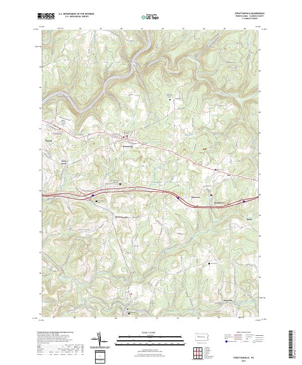
2023 Map of Strattanville
USGS Topo · Published 2023About this map
Strattanville and the eastern outskirts of Clarion anchor this landscape, where the plateaus of Clarion County are deeply incised by the Clarion River and its numerous tributaries. The geography is defined by a series of small, historic crossroads settlements such as Mechanicsville, Waterson, and Henderson, reflecting a traditional rural settlement pattern that persists alongside modern infrastructure like I-80.
Find a feature on this map
135 named features on this map. Tap any name to fly to it.
Don’t see what you’re looking for? This feature index may not catch every label — zoom into the map to look around manually.
Map Details
Editions of this 2023 Strattanville Map
This is the sole edition of this map. No revisions or reprints were ever made.
Other maps of this area

1906 · Clarion
USGS Topo · 1:62,500

1907 · Clarion
USGS Topo · 1:62,500

1918 · Loleta
USGS Topo · 1:62,500

1922 · Tionesta
USGS Topo · 1:62,500

1924 · Tionesta
USGS Topo · 1:62,500

1924 · Brookville
USGS Topo · 1:62,500

1926 · Brookville
USGS Topo · 1:62,500

1936 · Marienville
USGS Topo · 1:48,000

1941 · Marienville
USGS Topo · 1:62,500

1944 · Brookville
USGS Topo · 1:62,500