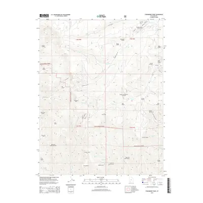
2014 Map of Strawberry Point
USGS Topo · Published 2014About this map
The Markagunt Plateau defines this high-elevation landscape in southern Utah, where the dramatic Pink Cliffs drop away into a complex system of canyons and gulches. Development is concentrated in the northern sections, particularly near the Strawberry Valley Estates Airport and along the small network of residential streets including Riviera St and Roberts St. Much of the land is managed as part of the Dixie National Forest, preserving a wilderness character marked by numerous named springs such as Twin Springs and Chokecherry Spring.
Find a feature on this map
54 named features on this map. Tap any name to fly to it.
Don’t see what you’re looking for? This feature index may not catch every label — zoom into the map to look around manually.
Map Details
Editions of this 2014 Strawberry Point Map
This is the sole edition of this map. No revisions or reprints were ever made.
Other maps of this area

1886 · Kanab
USGS Topo · 1:250,000

1953 · Cedar City
USGS Topo · 1:250,000

1954 · Orderville Canyon SE
USGS Topo · 1:24,000

1957 · Orderville Canyon NE
USGS Topo · 1:24,000

1958 · Cedar City
USGS Topo · 1:250,000

1958 · Orderville
USGS Topo · 1:62,500

1958 · Cedar Breaks
USGS Topo · 1:62,500

1958 · Panguitch Lake
USGS Topo · 1:62,500

1962 · Cedar City
USGS Topo · 1:250,000
1980 · Clear Creek Mountain
USGS Topo · 1:24,000