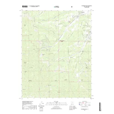
2020 Map of Strawberry Point
USGS Topo · Published 2020About this map
Strawberry Point serves as the dramatic centerpiece of this high-altitude landscape on the Markagunt Plateau, where the geological transition of the Pink Cliffs defines the southern edge of the terrain. This 2020 survey illustrates a region where recreation and remote aviation intersect within the Dixie National Forest. The presence of Strawberry Valley Estates Airport and Swains Creek Airport suggests a specialized pattern of seasonal settlement and accessibility in this high country.
Find a feature on this map
71 named features on this map. Tap any name to fly to it.
Don’t see what you’re looking for? This feature index may not catch every label — zoom into the map to look around manually.
Map Details
Editions of this 2020 Strawberry Point Map
This is the sole edition of this map. No revisions or reprints were ever made.
Other maps of this area

1886 · Kanab
USGS Topo · 1:250,000

1953 · Cedar City
USGS Topo · 1:250,000

1954 · Orderville Canyon SE
USGS Topo · 1:24,000

1957 · Orderville Canyon NE
USGS Topo · 1:24,000

1958 · Cedar City
USGS Topo · 1:250,000

1958 · Orderville
USGS Topo · 1:62,500

1958 · Cedar Breaks
USGS Topo · 1:62,500

1958 · Panguitch Lake
USGS Topo · 1:62,500

1962 · Cedar City
USGS Topo · 1:250,000
1980 · Clear Creek Mountain
USGS Topo · 1:24,000