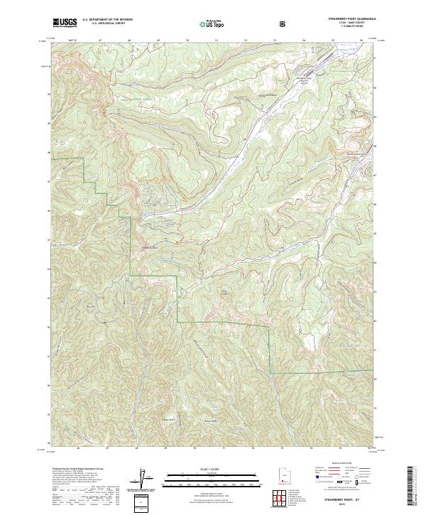
2023 Map of Strawberry Point
USGS Topo · Published 2023About this map
The Markagunt Plateau defines this high-elevation landscape in Dixie National Forest, where the terrain drops sharply at the Pink Cliffs. This modern survey illustrates the recreational and residential development of the region, anchored by Strawberry Valley Estates and its associated Strawberry Valley Estates Airport. The map documents an intricate network of forest roads and trails, such as the Virgin River Rim Trl and Strawberry Point Snowmobile Tr Trl, which navigate the complex geography of canyons and benches. Numerous water sources are identified across the arid plateaus, including Twin Springs, Chokecherry Spring, and Birch Spring. The drainage patterns are clearly marked by Willis Creek, Swains Creek, and the deep incisions of Orderville Gulch and Reubs Canyon, showing how water has carved the limestone and sandstone layers of southern Utah.
Find a feature on this map
75 named features on this map. Tap any name to fly to it.
Don’t see what you’re looking for? This feature index may not catch every label — zoom into the map to look around manually.
Map Details
Editions of this 2023 Strawberry Point Map
This is the sole edition of this map. No revisions or reprints were ever made.
Other maps of this area

1886 · Kanab
USGS Topo · 1:250,000

1953 · Cedar City
USGS Topo · 1:250,000

1954 · Orderville Canyon SE
USGS Topo · 1:24,000

1957 · Orderville Canyon NE
USGS Topo · 1:24,000

1958 · Cedar City
USGS Topo · 1:250,000

1958 · Orderville
USGS Topo · 1:62,500

1958 · Cedar Breaks
USGS Topo · 1:62,500

1958 · Panguitch Lake
USGS Topo · 1:62,500

1962 · Cedar City
USGS Topo · 1:250,000
1980 · Clear Creek Mountain
USGS Topo · 1:24,000