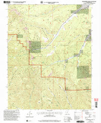
2002 Map of Strawberry Point
USGS Topo · Published 2005About this map
The Pink Cliffs dominate this portion of the Dixie National Forest, where the high elevations of the Markagunt Plateau break away into a labyrinth of canyons and gulches. This 2002 revision, based on surveys from the mid-to-late 20th century, highlights the intricate drainage patterns of the Strawberry Creek and Willis Creek watersheds. The landscape is defined by its verticality, with named features such as Strawberry Point and Pine Knoll providing significant overlooks above the surrounding terrain.
Find a feature on this map
40 named features on this map. Tap any name to fly to it.
Don’t see what you’re looking for? This feature index may not catch every label — zoom into the map to look around manually.
Map Details
Editions of this 2002 Strawberry Point Map
This is the sole edition of this map. No revisions or reprints were ever made.
Other maps of this area

1886 · Kanab
USGS Topo · 1:250,000

1953 · Cedar City
USGS Topo · 1:250,000

1954 · Orderville Canyon SE
USGS Topo · 1:24,000

1957 · Orderville Canyon NE
USGS Topo · 1:24,000

1958 · Cedar City
USGS Topo · 1:250,000

1958 · Orderville
USGS Topo · 1:62,500

1958 · Cedar Breaks
USGS Topo · 1:62,500

1958 · Panguitch Lake
USGS Topo · 1:62,500

1962 · Cedar City
USGS Topo · 1:250,000
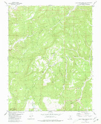
1980 · Clear Creek Mountain
USGS Topo · 1:24,000