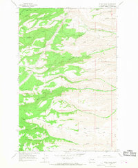
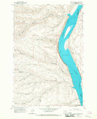
1966 Map of Stray Gulch
USGS Topo · Published 1968About this map
Tarpiscan Creek and its many forks define the complex drainage patterns of this Kittitas County landscape during the mid-1960s. The area is characterized by a network of steep canyons and gulches, including the prominent Stray Gulch and Brewton Gulch, which suggest a terrain managed for grazing and resource extraction rather than dense settlement. A high-altitude utility corridor, marked by a Pipeline, cuts across the northwestern corner, while various routes like Brewton Road and Caribou Perkins Road provide access to the remote interior.
Find a feature on this map
25 named features on this map. Tap any name to fly to it.
Don’t see what you’re looking for? This feature index may not catch every label — zoom into the map to look around manually.
Map Details
Editions of this 1966 Stray Gulch Map
2 editions found
Other maps of this area

1912 · Malaga
USGS Topo · 1:48,000

1913 · Wenatchee
USGS Topo · 1:62,500

1914 · Malaga
USGS Topo · 1:62,500

1915 · Wenatchee
USGS Topo · 1:62,500

1920 · Colockum Pass
USGS Topo · 1:125,000

1922 · Colockum Pass
USGS Topo · 1:125,000

1957 · Wenatchee
USGS Topo · 1:250,000
1966 · Colockum Pass SE
USGS Topo · 1:24,000
1966 · Colockum Pass
USGS Topo · 1:24,000
1966 · Cape Horn SE
USGS Topo · 1:24,000