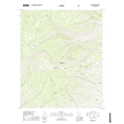
2018 Map of Strayhorse
USGS Topo · Published 2018About this map
Strayhorse sits as a lonely settlement within the high elevations of the Apache National Forest, surrounded by a landscape of volcanic peaks and distinct cienegas. The area is defined by its complex hydrology, where high-altitude wetlands like Butterfly Cienega, Cache Cienega, and KP Cienega provide rare water sources amidst the timber. A web of forest roads including Co RD 25 and the Highline trail suggests a history of timber management and remote ranching. The presence of the Blue Cabin Ruins north of Blue Peak points to an earlier era of human habitation or forest service history in this secluded corner of the state. Prominent summits such as Sawed Off Mtn and Indian Peak overlook deep drainages like Grapevine Canyon, illustrating the high-relief character of the eastern Arizona mountains.
Find a feature on this map
55 named features on this map. Tap any name to fly to it.
Don’t see what you’re looking for? This feature index may not catch every label — zoom into the map to look around manually.
Map Details
Editions of this 2018 Strayhorse Map
This is the sole edition of this map. No revisions or reprints were ever made.
Other maps of this area

1913 · Morenci
USGS Topo · 1:125,000

1915 · Morenci
USGS Topo · 1:125,000

1922 · Nutrioso
USGS Topo · 1:125,000

1954 · Clifton
USGS Topo · 1:250,000

1957 · Clifton
USGS Topo · 1:250,000

1958 · Clifton
USGS Topo · 1:250,000

1958 · Hannagan Meadow
USGS Topo · 1:62,500

1961 · Blue
USGS Topo · 1:62,500

1962 · Clifton
USGS Topo · 1:250,000

1967 · Robinson Mesa
USGS Topo · 1:24,000