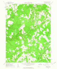
1961 Map of Strongstown
USGS Topo · Published 1963About this map
Strongstown sits at the center of this landscape, where the rural character of Indiana County meets the industry of the northern Appalachian coalfields in the early 1960s. The region is defined by the winding paths of Yellow Creek and Little Yellow Creek, which separate small agricultural clearings from the dense woodlands of Brush Valley. Evidence of resource extraction is prominent, with numerous Gas Wells, a Strip Mine, and a Tipple near Heilwood indicating a landscape still very much in production.
Find a feature on this map
45 named features on this map. Tap any name to fly to it.
Don’t see what you’re looking for? This feature index may not catch every label — zoom into the map to look around manually.
Map Details
Editions of this 1961 Strongstown Map
4 editions found
Other maps of this area

1902 · Indiana
USGS Topo · 1:62,500

1902 · Barnesboro
USGS Topo · 1:62,500

1904 · Barnesboro
USGS Topo · 1:62,500

1904 · Johnstown
USGS Topo · 1:62,500

1907 · Johnstown
USGS Topo · 1:62,500

1920 · New Florence
USGS Topo · 1:62,500

1921 · New Florence
USGS Topo · 1:48,000

1922 · New Florence
USGS Topo · 1:62,500

1943 · Punxsutawney
USGS Topo · 1:125,000

1944 · New Florence
USGS Topo · 1:62,500
Featured Places
- Brush Valley Township, PA
- Ewings Mill, Cherryhill Township
- Strongstown, Pine Township
- Cherryhill Township, PA
- Blacklick Township, PA