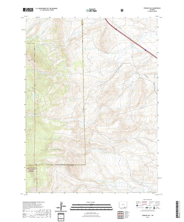
2021 Map of Strouss Hill
USGS Topo · Published 2021About this map
Medicine Bow Mountains define the southwestern portion of this high-altitude landscape, where the Medicine Bow National Forest covers the elevated terrain. The drainage patterns of the Laramie Mountains are evident through the complex network of creeks, including the several forks of N Fork Cooper Cr and Mill Cr. Notable landmarks like Strouss Hill, Coyote Hill, and Bunker Hill provide distinct vertical relief across the region. Human development is minimal and focused on ranching infrastructure, such as Woolf Ranch Rd and the Straus Ditch Number 2, which suggests the importance of water management in this arid environment. The map also captures the Carbon and Albany County line as it cuts north-to-south through the high country west of Lost Lake.
Find a feature on this map
27 named features on this map. Tap any name to fly to it.
Don’t see what you’re looking for? This feature index may not catch every label — zoom into the map to look around manually.
Map Details
Editions of this 2021 Strouss Hill Map
This is the sole edition of this map. No revisions or reprints were ever made.
Other maps of this area

1895 · Laramie
USGS Topo · 1:125,000

1902 · Laramie
USGS Topo · 1:125,000

1905 · Laramie
USGS Topo · 1:125,000

1906 · Medicine Bow
USGS Topo · 1:125,000

1906 · Laramie
USGS Topo · 1:125,000

1908 · Laramie
USGS Topo · 1:125,000

1908 · Medicine Bow
USGS Topo · 1:125,000

1954 · Cheyenne
USGS Topo · 1:250,000

1954 · Rawlins
USGS Topo · 1:250,000

1955 · Big Judson
USGS Topo · 1:24,000