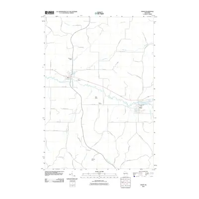
2010 Map of Strum
USGS Topo · Published 2010About this map
The Buffalo River winds through this Trempealeau County landscape, connecting the neighboring villages of Eleva and Strum during the early 21st century. The map illustrates a well-developed network of local roads and county highways that bridge numerous waterways, including Big Creek, Trout Creek, and Adams Creek. The presence of Strum Lake and its associated Strum 2WP338 Dam indicates local water management and recreation infrastructure central to the town's geography.
Find a feature on this map
67 named features on this map. Tap any name to fly to it.
Don’t see what you’re looking for? This feature index may not catch every label — zoom into the map to look around manually.
Map Details
Editions of this 2010 Strum Map
This is the sole edition of this map. No revisions or reprints were ever made.
Other maps of this area

1926 · Whitehall
USGS Topo · 1:62,500

1927 · Strum
USGS Topo · 1:62,500

1929 · Whitehall
USGS Topo · 1:62,500

1930 · Strum
USGS Topo · 1:62,500

1932 · Gilmanton
USGS Topo · 1:62,500

1932 · Mondovi
USGS Topo · 1:62,500

1953 · Eau Claire
USGS Topo · 1:250,000

1958 · Eau Claire
USGS Topo · 1:250,000

1964 · Eau Claire
USGS Topo · 1:250,000
1973 · Cleghorn
USGS Topo · 1:24,000