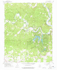
1962 Map of Stuart
USGS Topo · Published 1975About this map
The South Fork Spring River and Spring River converge in this Arkansas landscape, defining the boundaries between Fulton and Sharp counties. During the early 1960s, the emergence of Cherokee Village and Hidden Valley signaled a shift toward recreational development, centered around man-made water bodies like Thunderbird Lake, Lake Sequoyah, and Lake Mirandy. This transformation is further evidenced by the Cherokee Village Airstrip and youth retreats such as Camp Cedar Valley and Camp Ki-Ki-Kima. Despite this modernization, older layers of rural life remain visible along the St Louis - San Francisco railroad line. Family legacies are preserved at Taylor Cem, Hersperger Cem, and Wavrick Cem, while traditional river crossings like Slick Rock Ford and Brown Ford suggest the earlier transportation network used before the expansion of local roads.
Find a feature on this map
50 named features on this map. Tap any name to fly to it.
Don’t see what you’re looking for? This feature index may not catch every label — zoom into the map to look around manually.
Map Details
Editions of this 1962 Stuart Map
4 editions found
Other maps of this area

1957 · Poplar Bluff
USGS Topo · 1:250,000

1959 · Poplar Bluff
USGS Topo · 1:250,000

1960 · Poplar Bluff
USGS Topo · 1:250,000

1962 · Stuart
USGS Topo · 1:24,000

1962 · Ash Flat
USGS Topo · 1:24,000

1962 · Myron
USGS Topo · 1:24,000

1962 · Agnos
USGS Topo · 1:24,000

1962 · Mammoth Spring
USGS Topo · 1:24,000
1962 · Camp
USGS Topo · 1:24,000

1968 · Hardy
USGS Topo · 1:24,000