
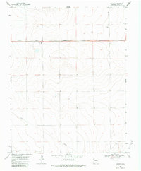
1968 Map of Stuart
USGS Topo · Published 1970About this map
Missouri Pacific railroad tracks bisect the high plains landscape of Kiowa County in the late 1960s, anchoring the small settlement of Stuart. The area’s agricultural and industrial character is defined by several Storage Bins and a Storage Bin strategically placed along the rail corridor. Local education is centered at the Plainview Sch, while aviation activity is noted at the Budde Landing Strip to the north.
Find a feature on this map
10 named features on this map. Tap any name to fly to it.
Don’t see what you’re looking for? This feature index may not catch every label — zoom into the map to look around manually.
Map Details
Editions of this 1968 Stuart Map
2 editions found
Other maps of this area

1890 · Granada
USGS Topo · 1:125,000

1892 · Cheyenne Wells
USGS Topo · 1:125,000

1892 · Granada
USGS Topo · 1:125,000

1894 · Cheyenne Wells
USGS Topo · 1:125,000

1894 · Granada
USGS Topo · 1:125,000

1954 · Lamar
USGS Topo · 1:250,000

1958 · Lamar
USGS Topo · 1:250,000

1968 · Sheridan Lake
USGS Topo · 1:24,000
1968 · Sheridan Lake SE
USGS Topo · 1:24,000
1968 · Lake Devore
USGS Topo · 1:24,000