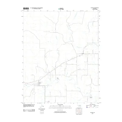
2010 Map of Stuart
USGS Topo · Published 2010About this map
The town of Stuart sits at a crossroads in Hughes County, where a grid of rural section roads meets the path of Us 270. This 2010 survey shows a landscape defined by its riparian networks, notably Coal Creek and Sandy Creek, which drain the undulating terrain typical of this part of Oklahoma. In the northeastern portion of the quadrangle, the community of Cabaniss serves as a local point of interest, while the presence of White Chimney Cemetery and Pryor Cemetery provides valuable landmarks for those researching regional genealogy. Modern water management is evident at the Oknoname 121002 Dam, part of a drainage system that includes Big Wildhorse Creek and Little Wildhorse Creek. The map documents a rural environment where established homesteads and local roads like Buffalo Rd and Scipio Rd facilitate movement across the cattle and farm country.
Find a feature on this map
32 named features on this map. Tap any name to fly to it.
Don’t see what you’re looking for? This feature index may not catch every label — zoom into the map to look around manually.
Map Details
Editions of this 2010 Stuart Map
This is the sole edition of this map. No revisions or reprints were ever made.
Other maps of this area

1896 · Coalgate
USGS Topo · 1:125,000

1898 · McAlester
USGS Topo · 1:125,000

1899 · Coalgate
USGS Topo · 1:125,000

1900 · Canadian
USGS Topo · 1:125,000

1900 · Wewoka
USGS Topo · 1:125,000

1900 · Coalgate
USGS Topo · 1:125,000

1909 · Mc Alester
USGS Topo · 1:125,000

1946 · Fort Smith
USGS Topo · 1:250,000

1950 · Mcalester
USGS Topo · 1:250,000

1954 · Oklahoma City
USGS Topo · 1:250,000