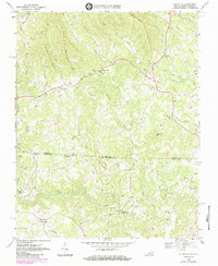
1968 Map of Stuart SE
USGS Topo · Published 1984About this map
Dan River waterpower once drove the milling operations of this borderland, where the Virginia North Carolina state line divides the landscape into Patrick Co and Stokes Co. Milling heritage is prominent here with Jessup Mill located along the river and Georges Mill positioned further downstream. The terrain is defined by prominent rises like Willard Mtn and Pikes Mountain, which overlook a network of small agricultural and church-centered communities.
Find a feature on this map
49 named features on this map. Tap any name to fly to it.
Don’t see what you’re looking for? This feature index may not catch every label — zoom into the map to look around manually.
Map Details
Editions of this 1968 Stuart SE Map
3 editions found
Other maps of this area

1926 · Critz
USGS Topo · 1:48,000

1928 · Stuart
USGS Topo · 1:48,000

1928 · Critz
USGS Topo · 1:62,500

1931 · Stuart
USGS Topo · 1:62,500

1953 · Winston-Salem
USGS Topo · 1:250,000

1955 · Winston-Salem
USGS Topo · 1:250,000

1962 · Winston-Salem
USGS Topo · 1:250,000

1964 · Hanging Rock
USGS Topo · 1:24,000

1964 · Pilot Mountain
USGS Topo · 1:24,000

1967 · Patrick Springs
USGS Topo · 1:24,000