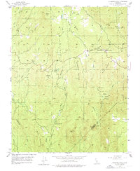
1947 Map of Stumpfield Mtn.
USGS Topo · Published 1976About this map
Stumpfield Mountain dominates the central landscape of this Sierra Nevada foothills region during the late 1940s, marking the rugged divide between the drainage systems of the Chowchilla River. The map records a sparsely populated territory where remote rural institutions served localized family clusters, most notably at the Chowchilla Sch near Elliott Corner and the Indian Peak Sch further south.
Find a feature on this map
31 named features on this map. Tap any name to fly to it.
Don’t see what you’re looking for? This feature index may not catch every label — zoom into the map to look around manually.
Map Details
Editions of this 1947 Stumpfield Mtn. Map
4 editions found
Other maps of this area

1897 · Yosemite
USGS Topo · 1:125,000

1900 · Yosemite
USGS Topo · 1:125,000

1903 · Yosemite
USGS Topo · 1:125,000

1909 · Yosemite
USGS Topo · 1:125,000

1912 · Mariposa
USGS Topo · 1:125,000

1947 · Mariposa
USGS Topo · 1:24,000

1947 · Mariposa
USGS Topo · 1:250,000

1947 · El Portal
USGS Topo · 1:62,500

1947 · Mariposa
USGS Topo · 1:62,500

1947 · Buckingham Mtn
USGS Topo · 1:24,000