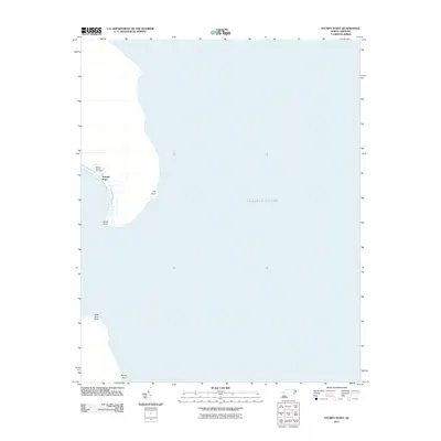
2011 Map of Stumpy Point
USGS Topo · Published 2011About this map
Stumpy Point occupies a narrow peninsula on this coastal survey, defined by the expansive waters of Croatan Sound to the east. The settlement is centered near the sheltered water of the point, with a small cluster of roads leading toward the Shiloh Church Cemetery. The surrounding landscape is characterized by a series of distinct coastal markers including Old Point, Drain Point, Wild Boar Point, and Sandy Point at the southern edge of the quadrangle. This 2011 edition shows the area's geography just as the modern digital mapping standards were being established, preserving the exact shoreline and local nomenclature of this Dare County maritime community.
Find a feature on this map
8 named features on this map. Tap any name to fly to it.
Don’t see what you’re looking for? This feature index may not catch every label — zoom into the map to look around manually.
Map Details
Editions of this 2011 Stumpy Point Map
This is the sole edition of this map. No revisions or reprints were ever made.
Other maps of this area

1943 · Roanoke Island
USGS Topo · 1:125,000

1951 · Long Shoal Point
USGS Topo · 1:24,000

1953 · Wanchese
USGS Topo · 1:24,000

1953 · Stumpy Point
USGS Topo · 1:24,000

1953 · East Lake SE
USGS Topo · 1:24,000

1953 · Engelhard NE
USGS Topo · 1:24,000

1955 · Wanchese
USGS Topo · 1:250,000

1957 · Manteo
USGS Topo · 1:250,000

1960 · Manteo
USGS Topo · 1:250,000

1985 · Manteo
USGS Topo · 1:100,000