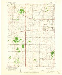
1959 Map of Sturtevant
USGS Topo · Published 1960About this map
Sturtevant serves as a central hub for the rail-and-road network of eastern Wisconsin, where the Chicago Milwaukee St Paul and Pacific meets the Chicago and North Western lines. This mid-century landscape reflects a transition from traditional agriculture to a more connected suburban and industrial corridor. The map reveals a dense network of local education and community sites, from St Bonaventure Sch and Barlett Sch to the quiet grounds of the West Lawn Memorial Cemetery.
Find a feature on this map
48 named features on this map. Tap any name to fly to it.
Don’t see what you’re looking for? This feature index may not catch every label — zoom into the map to look around manually.
Map Details
Editions of this 1959 Sturtevant Map
4 editions found
Other maps of this area

1891 · Bayview
USGS Topo · 1:62,500

1891 · Muskego
USGS Topo · 1:62,500

1892 · Racine
USGS Topo · 1:62,500

1893 · Silver Lake
USGS Topo · 1:62,500

1901 · Bayview
USGS Topo · 1:62,500

1901 · Muskego
USGS Topo · 1:62,500

1905 · Racine
USGS Topo · 1:62,500

1906 · Silver Lake
USGS Topo · 1:62,500

1954 · Rockford
USGS Topo · 1:250,000

1955 · Rockford
USGS Topo · 1:250,000