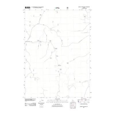
2011 Map of Sublett Troughs
USGS Topo · Published 2011About this map
Eyrie Peak rises as a prominent landmark in this 2011 depiction of the Idaho highlands, marking the rugged divide within the Sublett Range. The map detail reveals a complex network of seasonal drainages and canyons, including the dramatic Twin Canyons and Ward Canyon to the north. These geological features dictate the placement of high-elevation routes such as Hartley Canyon Rd and NFD 573 Rd, which serve as the primary conduits through this high-desert environment.
Find a feature on this map
24 named features on this map. Tap any name to fly to it.
Don’t see what you’re looking for? This feature index may not catch every label — zoom into the map to look around manually.
Map Details
Editions of this 2011 Sublett Troughs Map
This is the sole edition of this map. No revisions or reprints were ever made.
Other maps of this area

1954 · Pocatello
USGS Topo · 1:250,000

1958 · Pocatello
USGS Topo · 1:250,000

1958 · Sublett
USGS Topo · 1:62,500

1959 · Strevell
USGS Topo · 1:62,500

1973 · Juniper
USGS Topo · 1:24,000

1973 · Hartley Peak
USGS Topo · 1:24,000

1973 · Sublett Troughs
USGS Topo · 1:24,000
1973 · Roy
USGS Topo · 1:24,000
1973 · Badger Hole Spring
USGS Topo · 1:24,000
1973 · Roy NE
USGS Topo · 1:24,000