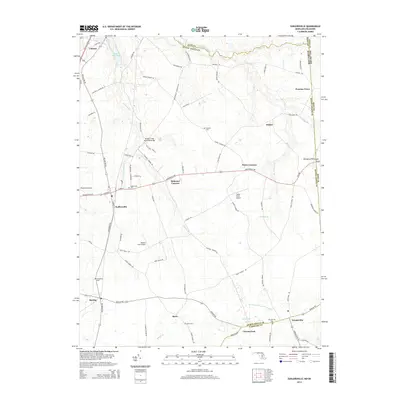
2014 Map of Sudlersville
USGS Topo · Published 2014About this map
Sudlersville serves as a central hub on the Delmarva Peninsula within this 2014 survey, where the landscape is defined by its deep agricultural roots and a complex network of drainage and mill ponds. The northern reaches are dominated by the Unicorn Br and its associated water features, including Unicorn Lake and Unicorn Mill Pond, while the southern area is marked by the Harrington Beaverdam-Ditch. This map highlights a transition from traditional farming settlements like Duhamel Corners and Peters Corners to the modern presence of small-scale aviation at Taylor Field Airport and Whalen Field Airport. Several rural burial grounds, such as Holdens Cem and Busic Cem, provide important landmarks for those tracing the history of the local families who have inhabited this borderland between Maryland and Delaware for generations.
Find a feature on this map
80 named features on this map. Tap any name to fly to it.
Don’t see what you’re looking for? This feature index may not catch every label — zoom into the map to look around manually.
Map Details
Editions of this 2014 Sudlersville Map
This is the sole edition of this map. No revisions or reprints were ever made.
Other maps of this area

1899 · Dover
USGS Topo · 1:125,000

1900 · Cecilton
USGS Topo · 1:62,500

1905 · Barclay
USGS Topo · 1:62,500

1906 · Dover
USGS Topo · 1:125,000

1920 · Dover
USGS Topo · 1:125,000

1926 · Wyoming
USGS Topo · 1:48,000

1930 · Wyoming
USGS Topo · 1:62,500

1931 · Wyoming
USGS Topo · 1:62,500

1931 · Smyrna
USGS Topo · 1:62,500
1944 · Church Hill
USGS Topo · 1:31,680