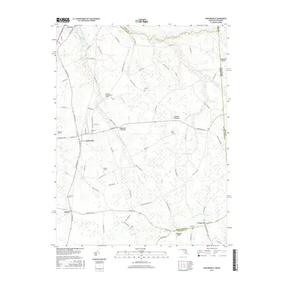
2017 Map of Sudlersville
USGS Topo · Published 2017About this map
Sudlersville serves as the central hub of this agricultural landscape on the Upper Eastern Shore, where the intersection of Sudlersville Rd and Millington Rd anchors a community defined by its proximity to the Delaware state line. The terrain is a network of small watercourses and drainage systems like Unicorn Br and Andover Br, which feed into landmarks such as Unicorn Mill Pond and Unicorn Lake. For genealogists and local historians, the map provides precise locations for several rural burial grounds, including Holdens Cem and Busic Cem, alongside established settlements such as Barclay, Templeville, and the aptly named Peters Corners. The presence of Roseland Airport and athletic grounds like Whalen Field reflects the modern land use of these historic farming crossroads.
Find a feature on this map
76 named features on this map. Tap any name to fly to it.
Don’t see what you’re looking for? This feature index may not catch every label — zoom into the map to look around manually.
Map Details
Editions of this 2017 Sudlersville Map
This is the sole edition of this map. No revisions or reprints were ever made.
Other maps of this area

1899 · Dover
USGS Topo · 1:125,000

1900 · Cecilton
USGS Topo · 1:62,500

1905 · Barclay
USGS Topo · 1:62,500

1906 · Dover
USGS Topo · 1:125,000

1920 · Dover
USGS Topo · 1:125,000

1926 · Wyoming
USGS Topo · 1:48,000

1930 · Wyoming
USGS Topo · 1:62,500

1931 · Wyoming
USGS Topo · 1:62,500

1931 · Smyrna
USGS Topo · 1:62,500
1944 · Church Hill
USGS Topo · 1:31,680