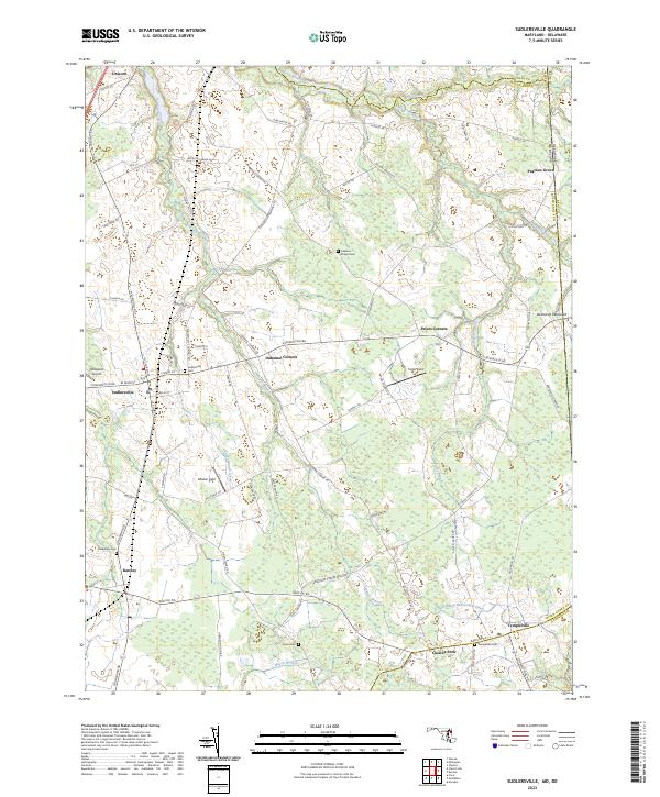
2023 Map of Sudlersville
USGS Topo · Published 2023About this map
Sudlersville and its agricultural surroundings on the Delmarva Peninsula are defined by a complex network of drainage ditches and small headwaters. The landscape is dotted with small, long-established hamlets like Unicorn, Peters Corners, and Duhamel Corners, which serve as nodes in a grid of secondary roads such as Millington Rd and Blanco Rd. Waterways like the Andover Branch and Unicorn Branch feed into the broader regional drainage, while man-made features like the Chapel Branch Ditch and Harrington Beaverdam Ditch illustrate the engineering required to manage the low-lying terrain for farming. Family-named landmarks and rural infrastructure are prominent, including the Roseland Airport and numerous burial grounds such as Holdens Chapel Cem and Busic Cem. The map also traces the political geography of the Eastern Shore, capturing the borders where Kent and Queen Anne's counties meet and the state line at Maryland and Delaware.
Find a feature on this map
77 named features on this map. Tap any name to fly to it.
Don’t see what you’re looking for? This feature index may not catch every label — zoom into the map to look around manually.
Map Details
Editions of this 2023 Sudlersville Map
This is the sole edition of this map. No revisions or reprints were ever made.
Other maps of this area

1899 · Dover
USGS Topo · 1:125,000

1900 · Cecilton
USGS Topo · 1:62,500

1905 · Barclay
USGS Topo · 1:62,500

1906 · Dover
USGS Topo · 1:125,000

1920 · Dover
USGS Topo · 1:125,000

1926 · Wyoming
USGS Topo · 1:48,000

1930 · Wyoming
USGS Topo · 1:62,500

1931 · Wyoming
USGS Topo · 1:62,500

1931 · Smyrna
USGS Topo · 1:62,500
1944 · Church Hill
USGS Topo · 1:31,680