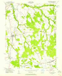
1953 Map of Sudlersville
USGS Topo · Published 1955About this map
The agrarian landscape of the Maryland-Delaware border region centers on Sudlersville, where the intersection of rural roads and the Pennsylvania Railroad line shaped local commerce in the mid-20th century. This survey reveals a dense network of crossroad settlements, often named for local families, such as Duhamel Corners, Peters Corners, and Schenk Corners. These clusters, alongside towns like Barclay and Templeville, reflect the dispersed but connected social fabric of Northern Queen Anne's County before the consolidation of modern thoroughfares.
Find a feature on this map
32 named features on this map. Tap any name to fly to it.
Don’t see what you’re looking for? This feature index may not catch every label — zoom into the map to look around manually.
Map Details
Editions of this 1953 Sudlersville Map
2 editions found
Other maps of this area

1899 · Dover
USGS Topo · 1:125,000

1900 · Cecilton
USGS Topo · 1:62,500

1905 · Barclay
USGS Topo · 1:62,500

1906 · Dover
USGS Topo · 1:125,000

1920 · Dover
USGS Topo · 1:125,000

1926 · Wyoming
USGS Topo · 1:48,000

1930 · Wyoming
USGS Topo · 1:62,500

1931 · Wyoming
USGS Topo · 1:62,500

1931 · Smyrna
USGS Topo · 1:62,500
1944 · Church Hill
USGS Topo · 1:31,680