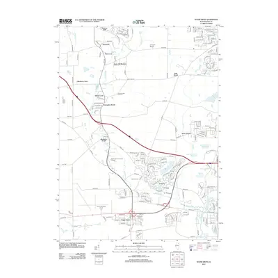
2012 Map of Sugar Grove
USGS Topo · Published 2012About this map
Sugar Grove and the surrounding Kane County countryside appear in a phase of significant suburban expansion and educational development. The presence of Waubonsee Community College and the Aurora Municipal Airport highlights the area's role as a regional hub for both academics and aviation. Residential enclaves such as Prestbury, Blackberry Woods, and Nottingham Woods are interspersed with preserved landscape features like Johnsons Mound and Bald Mound, suggesting a balance between new housing and the natural terrain.
Find a feature on this map
49 named features on this map. Tap any name to fly to it.
Don’t see what you’re looking for? This feature index may not catch every label — zoom into the map to look around manually.
Map Details
Editions of this 2012 Sugar Grove Map
This is the sole edition of this map. No revisions or reprints were ever made.
Other maps of this area

1925 · Yorkville
USGS Topo · 1:62,500

1932 · Geneva
USGS Topo · 1:62,500

1937 · Sycamore
USGS Topo · 1:62,500

1948 · Geneva
USGS Topo · 1:62,500

1948 · Sandwich
USGS Topo · 1:62,500

1949 · Geneva
USGS Topo · 1:24,000

1950 · Sandwich
USGS Topo · 1:62,500

1950 · Aurora North
USGS Topo · 1:24,000

1953 · Yorkville
USGS Topo · 1:24,000
1954 · Aurora South
USGS Topo · 1:24,000