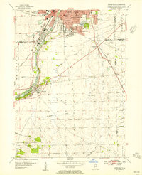
1954 Map of Aurora South
USGS Topo · Published 1955About this map
The Fox River corridor serves as the primary artery of development in this mid-century survey, anchoring the industrial and residential growth of Aurora and Montgomery. While the northern portion of the map is defined by the dense urban fabric of the South Park neighborhood and landmark institutions like Copley Hospital, the landscape quickly transitions into the agricultural expanse of Oswego and Na-Au-Say. This transition is marked by a series of established burial grounds, including Spring Lake Cem and Riverside Cem, which border the river's winding path south toward the village of Oswego.
Find a feature on this map
51 named features on this map. Tap any name to fly to it.
Don’t see what you’re looking for? This feature index may not catch every label — zoom into the map to look around manually.
Map Details
Editions of this 1954 Aurora South Map
4 editions found
Other maps of this area

1892 · Joliet
USGS Topo · 1:62,500

1908 · Wheaton
USGS Topo · 1:62,500

1923 · Joliet
USGS Topo · 1:62,500

1925 · Yorkville
USGS Topo · 1:62,500

1932 · Geneva
USGS Topo · 1:62,500

1948 · Wheaton
USGS Topo · 1:62,500

1948 · Geneva
USGS Topo · 1:62,500

1950 · Aurora North
USGS Topo · 1:24,000

1953 · Plattville
USGS Topo · 1:24,000

1953 · Naperville
USGS Topo · 1:24,000