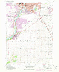
1954 Map of Aurora South
USGS Topo · Published 1981About this map
The Fox River carves a path through the heart of this landscape, separating the industrial and residential growth of Aurora and Montgomery from the more agricultural character of Oswego to the south. This survey captures a transitional moment for the region, where older landmarks like Riverside Cem and Mt Olivet Cem sit alongside mid-century expansions like Scraper-Moecherville. The map provides significant detail for genealogists, documenting institutional hubs such as Copley Hospital and several rural educational centers like Scotch Sch and Bardwell Sch. Transport infrastructure is heavily represented by the Burlington Northern and Elgin Joliet and Eastern rail lines, which influenced the development patterns of the Oswego and Bristol townships. Away from the river, the terrain flattens toward Tamarack and Wolfs, where smaller airfields like the Wheatland Airfield reflect the era's light aviation.
Find a feature on this map
50 named features on this map. Tap any name to fly to it.
Don’t see what you’re looking for? This feature index may not catch every label — zoom into the map to look around manually.
Map Details
Editions of this 1954 Aurora South Map
4 editions found
Other maps of this area

1892 · Joliet
USGS Topo · 1:62,500

1908 · Wheaton
USGS Topo · 1:62,500

1923 · Joliet
USGS Topo · 1:62,500

1925 · Yorkville
USGS Topo · 1:62,500

1932 · Geneva
USGS Topo · 1:62,500

1948 · Wheaton
USGS Topo · 1:62,500

1948 · Geneva
USGS Topo · 1:62,500

1950 · Aurora North
USGS Topo · 1:24,000

1953 · Plattville
USGS Topo · 1:24,000

1953 · Naperville
USGS Topo · 1:24,000