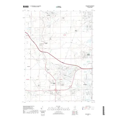
2018 Map of Sugar Grove
USGS Topo · Published 2018About this map
Sugar Grove serves as the central hub in this Kane County landscape, where the traditional agricultural grid meets modern transportation and education infrastructure. The western edge of Aurora and the village of North Aurora show significant development, particularly around the complex water management systems of Lake Run and its various diversions. To the west, the Aurora Municipal Airport and Waubonsee Community College mark the expansion of civic and educational services beyond the urban core.
Find a feature on this map
35 named features on this map. Tap any name to fly to it.
Don’t see what you’re looking for? This feature index may not catch every label — zoom into the map to look around manually.
Map Details
Editions of this 2018 Sugar Grove Map
This is the sole edition of this map. No revisions or reprints were ever made.
Other maps of this area

1925 · Yorkville
USGS Topo · 1:62,500

1932 · Geneva
USGS Topo · 1:62,500

1937 · Sycamore
USGS Topo · 1:62,500

1948 · Geneva
USGS Topo · 1:62,500

1948 · Sandwich
USGS Topo · 1:62,500

1949 · Geneva
USGS Topo · 1:24,000

1950 · Sandwich
USGS Topo · 1:62,500

1950 · Aurora North
USGS Topo · 1:24,000

1953 · Yorkville
USGS Topo · 1:24,000
1954 · Aurora South
USGS Topo · 1:24,000