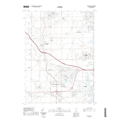
2021 Map of Sugar Grove
USGS Topo · Published 2021About this map
Sugar Grove and the western edge of Aurora define this landscape in Kane County, where modern suburban development meets the agricultural roots of northern Illinois. The terrain is punctuated by distinctive glacial remnants like Johnsons Mound and Bald Mound, which rise above the surrounding plains. The local hydrological system is heavily managed, featuring numerous diversions such as the Lake Run South of I-88 Diversion and the Aurora Chain of Lakes Cherry Hills Diversion, reflecting the area's transition from open prairie to an integrated transportation and residential hub.
Find a feature on this map
119 named features on this map. Tap any name to fly to it.
Don’t see what you’re looking for? This feature index may not catch every label — zoom into the map to look around manually.
Map Details
Editions of this 2021 Sugar Grove Map
This is the sole edition of this map. No revisions or reprints were ever made.
Other maps of this area

1925 · Yorkville
USGS Topo · 1:62,500

1932 · Geneva
USGS Topo · 1:62,500

1937 · Sycamore
USGS Topo · 1:62,500

1948 · Geneva
USGS Topo · 1:62,500

1948 · Sandwich
USGS Topo · 1:62,500

1949 · Geneva
USGS Topo · 1:24,000

1950 · Sandwich
USGS Topo · 1:62,500

1950 · Aurora North
USGS Topo · 1:24,000

1953 · Yorkville
USGS Topo · 1:24,000
1954 · Aurora South
USGS Topo · 1:24,000