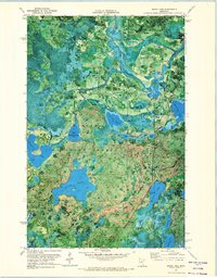
1971 Map of Sugar Lake
USGS Topo · Published 1974About this map
The Mississippi River winds through the northern reaches of this landscape, marking the northern boundary of the Indian Reservation Boundary and the Schoolcraft State Recreation Area. This orthophotomap, derived from 1969 aerial photography, provides a rare visual record of the region's complex hydrology and dense forest cover before modern development altered these shores. Much of the terrain is protected by the Chippewa National Forest and Remer State Forest, where numerous smaller water bodies like Little Vermillion Lake and Skunk Lake dot the wetlands. The presence of West Cohasset Chapel and a Gravel Pit near the Cass and Itasca county line indicates the sparse but steady human footprint in an area dominated by lakes and marshes. Researchers can trace the natural contours of Sugar Lake and the Fisher Islands, seeing the land exactly as it was during the field checks of the early 1970s.
Find a feature on this map
29 named features on this map. Tap any name to fly to it.
Don’t see what you’re looking for? This feature index may not catch every label — zoom into the map to look around manually.
Map Details
Editions of this 1971 Sugar Lake Map
This is the sole edition of this map. No revisions or reprints were ever made.
Other maps of this area

1953 · Siseebakwet Lake
USGS Topo · 1:24,000

1953 · Cohasset West
USGS Topo · 1:24,000

1954 · Hibbing
USGS Topo · 1:250,000

1957 · Hibbing
USGS Topo · 1:250,000

1958 · Hibbing
USGS Topo · 1:250,000

1964 · Hibbing
USGS Topo · 1:250,000

1970 · Big Thunder Peak
USGS Topo · 1:24,000
1970 · Deer River
USGS Topo · 1:24,000

1970 · Ball Club
USGS Topo · 1:24,000
1971 · Remer
USGS Topo · 1:24,000